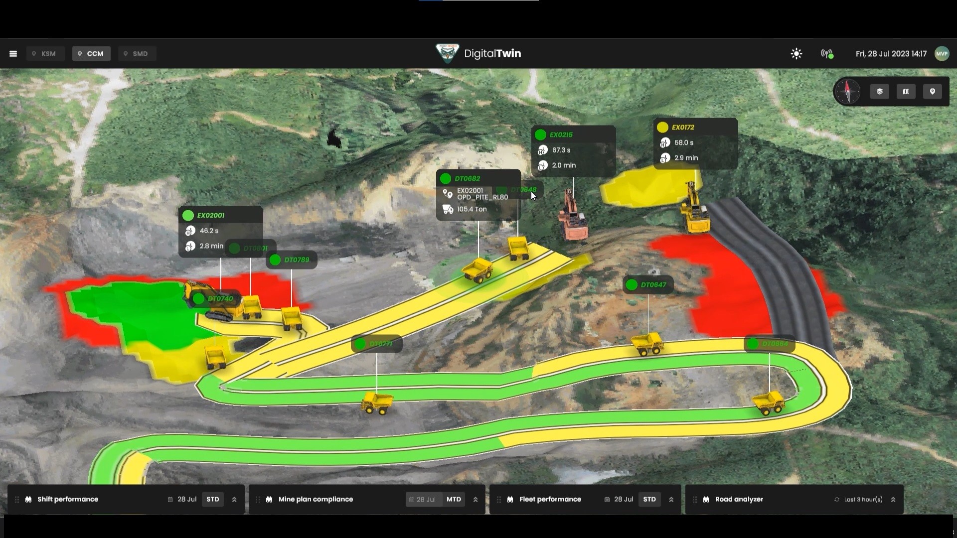
Originating from a thorough understanding of Petrosea's operational landscape, Virtu embarked on a transformative journey to revolutionize the coal mining company's processes. Recognizing the inherent challenges in traditional mining methodologies, we aimed to introduce a solution that would transcend the limitations of conventional approaches.
Central to this endeavor was the integration of cutting-edge digital technologies to create a digital twin solution tailored specifically to Petrosea's needs. As part of this initiative, we set out to harness the power of drone LiDAR technology to create a detailed virtual map of Petrosea's mining infrastructure.
This virtual map would serve as the foundation for the digital twin, offering Petrosea an unparalleled overview of their operations in real time. Over time, the map would be adjusted to predict the changes in topology as the excavation works progresses.
In addition, the virtual map is overlaid with real-time data from Petrosea's Fleet Management System. This integration enabled Petrosea to visualize detailed information about each vehicle within the mining operation, including their precise locations, routes, and operational status. By seamlessly merging these datasets, Virtu provided Petrosea with a comprehensive and dynamic overview of their entire mining operation, empowering them to make informed decisions and optimize their mining endeavors in real time.
Ultimately, this project is seamlessly delivered to Petrosea's three key platforms: Web, Mobile app and Mixed Reality.


